Mud slides near Atlanta hamper fire crews
Fire officials are still assessing damage caused by Sunday afternoon's mud and debris slides on the Middle Fork Boise River Road. Radar readings estimate thunderstorms dropped between 1.5 and 2.2 inches of rain in the slide area between noon and 2 p.m. Sunday. The remainder of the Hot Creek Fire received only .02-.03 inches of rain.
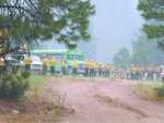
Mudslides caused by the isolated but heavy rains temporarily stranded firefighters who were working on the Hot Creek Fire along the Middle Fork Boise River Road between the Queens River and Weatherby Airstrip on Sunday afternoon. Two crew vehicles were damaged, however, there were no injuries reported. All fire personnel were safely removed from the slide area, and returned to base camps in Atlanta and Dutch Creek.
Three major and multiple minor mud slides across a stretch of the Middle Fork Boise River between the Queens River and Steele Creek inundated portions the Middle Fork Road with mud and debris. The road remains closed beyond the Swanholm/Phifer Creek Road junction near the Weatherby's airstrip and it remains uncertain how soon it will be reopened.

Both the Phifer Creek and James Creek Roads are still closed to the public.
Atlanta residents are being allowed to leave and return using scheduled escorts over James Creek. The route provides the only current road access in and out of Atlanta.
Work continues on the Hot Creek Fire, with the acreage holding steady at 26,560 and containment increasing to 60 percent. Fire activity is minimal, thanks to continued cooler temperatures and higher humidity.
Some Type II crews have been released as they complete their maximum assignment period. Additional Hot Shot crews are being brought in to continue the fireline construction on the steeper and more rugged portions of the fire.
Despite recent rain in some areas, fire conditions remain critical and Stage I Fire Restrictions are still in effect. Campfires are restricted to developed recreation sites and smoking is allowed only in cleared spaces of at least 3-feet diameter, or in vehicles or buildings.
Pictures of the mudslides and fire updates and maps of the fire can be found on the Boise Interagency Dispatch Center's web site (www.id.blm.gov/boisedispatch), or the Boise National Forest web site (www.fs.fed.us/r4/boise) or (ftp://ftp2.fs.fed.us/incoming/wo_fam/Hot_Creek).
